Bowman West
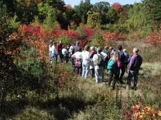
Photo Courtesy of Bernie Thompson
WCLT meadow on Charm Bracelet Walk
The Bowman West area is comprised of parts of the Westborough Conservation Area and property given to the Westborough Community Land Trust by the developers of Valley View Estates. The entrance to the area is opposite the Bowman Street parking lot for the Westborough Conservation Area. At one time, the land around the entrance was part of the Town of Westborough Tree Farm.
This area was inaccessible until 2000, when the Westborough Open Space Committee and WCLT undertook the effort to clear the first trail through the properties and clean up the area. Later David Eypper, an Eagle Scout candidate in town, constructed a second trail, creating loop through the properties.
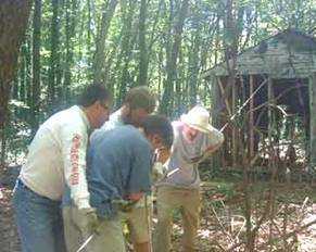
Photo Courtesy of Harry Newell
Removing an abandoned building
At present, the trails consist of an entry trail from Bowman Street, a loop around the bulk of the property, and a trail to Long Drive near Ruggles Street. For the benefit of the Valley View subdivision residents, we ask you not to park on Long Drive. Instead, park at the Westborough Conservation Area or further along the Charm Bracelet.
It is hoped that in the future several more trails can be added to the network in this area.
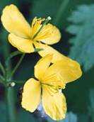
Photo Courtesy of Garry Kessler
Celandine on the property
![]()
![]()
![]()
![]()
Map to Westborough Conservation Area
Sandra Pond (previous segment of the Charm Bracelet)
Orchard Hill (next segment of the Charm Bracelet)
Westborough Community Land Trust, PO Box 838, Westborough , MA 01581
-- Contact -- Join! --