Crane Swamp
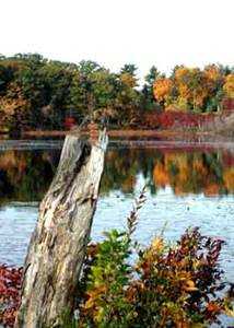
Photo Courtesy of Betty Tetreault
Little Chauncy Pond from the trail
The largest of the properties in this area is the Westboro Wildlife Management Area that is operated by the Massachusetts Division of Fisheries and Wildlife . This is an area of 427 acres extending from Milk Street (Route 135) on the west to east of Lyman Street. Hunting is allowed year-round (except on Sundays) in this area, so walkers should wear orange. This area also allows mountain biking.
East of the Wildlife Management Area is the Sudbury Valley Trustees . Cedar Hill Reservation. This hill is a glacial drumlin offering panoramic views of Westborough.
South and east of Cedar Hill lies Crane Swamp. Much of the land in the swamp belongs to the Metropolitan District Commission (MDC) . This unique area has a couple of trails that provide views of the swamp. At present the northern parts of the MDC property are closed due to the construction of the MWRA Water Treatment Plant. The MWRA will reopen the trail in 2005.
Finally, on the eastern edge of Crane Swamp lies the SVT Sawink Reservation.
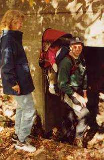
Photo Courtesy of Maggie Kosovsky
Trail under Lyman Street
The trails on the east side of Lyman Street were not connected to the Westboro WMA until 2001. In that year, WCLT and the Northborough Trail Committee built a trail from the Little Chauncy Pond access road to the SVT Cedar Hill property. This trail crosses a number of different wildlife habitats, including swamp, fields, pine forest, oak forest, and a wet meadow. There is a variety of wildlife here, including otters and a pack of coyotes that play in the fields.
A loop can be made by starting at the Little Chauncy Pond access road and hiking to the base of Cedar Hill, then out the access road to Lyman Street and back to your car. The loop can be extended by going over the top of Cedar Hill, then taking the trail to Walker Street to the MDC road, and following the road back to Lyman Street.
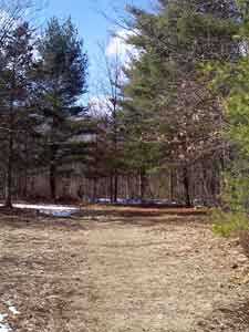
Photo Courtesy of Don Burn
Trail at Sawink Farm
![]()
![]()
![]()
![]()
![]()
![]()
Map to Lyman Street Entrance West (follow signs to Little Chauncy Fishermans Access)
Map to Lyman Street Entrance East (follow dirt road to parking)
Map to the Scholastic Book Fair Entrance (park at the SVT signs)
Map to Haskell Ball Fields (trail across street)
Map to SVT's Sawink Farm Reservation
Westboro WMA (previous segment of the Charm Bracelet)
No next segment of the Charm Bracelet at present
Westborough Community Land Trust, PO Box 838, Westborough , MA 01581
-- Contact -- Join! --